Sunday, July 02, 2006
Waukegan to Kenosha Bike Ride...
Let's see... Every now and then, I take a route that's approximately 18 miles from my house to Kenosha Harbor. Thus, it's nearly 40mi round trip. Not a bad ride. However I'm not going to tell everyone online where I live, so I'll move the starting place to somewhere more public...
Here's the general format. I'll name a landmark or location, and its name will have a link to the sattellite view on google maps. That way you'll know exactly where it is. Also if you're enough of a geek to mark off waypoints on a GPS, you can snag the latitude and longitude from the google map address and keep notes.
Start point... Lyon's Woods Forest Preserve. In the pines, the pines, where the sun never shines - the deer flies bite a lot. Well they do at some times of the day, thus a good reason to get moving on your bicycle. But the place does have public restrooms (no running water). Usually there's plenty of parking, so it's a good start point. Follow the trail that goes west (there's two actually, doesn't matter as they meet back up). Cross North Avenue, and keep following the trail westward. If you're on target, you'll meet up with the McClory trail here.
Now follow the McClory trail and head North. There will be a path bridge over Wadsworth Road. The next intersection after this bridge is 33rd Street in Zion. This is where you head east.
Following 33rd Street eastbound, it ends at Sheridan Road. There will be a shopping plaza on the other side. Cross over, and head north through the lot in front of the plaza. Then follow the sidewalk northbound along Sheridan Rd. Immediately there will be a downhill turnoff to the "Edina Park Trail". Paved but bumpy. Also somewhat narrow and on a steep grade. Cover your brakes and use caution. Others on the trail may be going uphill, and there's the occasional tree branch or shopping cart as well.
Now we follow the "Edina Park Trail" until we see the Metra Green Line Zion stop and the defunct Zion Nuclear Plant on your right. You will also see a small playground on your left and a sign for Edina Park (Thus my naming of the trail. I'm uncertain if that's official though.) This is where you turn right onto Shiloh Blvd.
Follow Shiloh Blvd eastbound to a parking lot that's on the left before the nuke plant straight ahead. As far as I know, the nuke plant is retired in place. So don't go nosing around there unless you want to "make friends" with homie-land security.
From this lot, there's a motor vehicle barrier on the north end. This leads to a closed (to motor traffic) road which now functions as a trail. It's very nice and wide, but nature is starting to take it back. Thus it's plenty bumpy in places. If you look towards the lake in the right spot, you can see a perfectly fine Vestas wind turbine being wasted and not doing much. (It would be making some nice kw, if it weren't locked and feathered.) It was part of Commonwealth Edison's (long retired) Powerhouse Educational Center (That cool looking industrial building that's been broken down. What a shame.)
Now follow the path north it ends at another that goes east and west. Go east . At one time it went straight to Lake Michigan, which I think was pretty cool. But some weinie probably worried that people would ride their bikes off it or something (stupid, since it's rocky below), so now there's a piece of driftwood blocking it there. I suppose it makes a nice place to sit and enjoy the quietness. But before getting to the lake, there's another northbound path on your left. You'll go this way unless you want to chill for a bit.
Follow this, and you'll see an aviation omnidirectional beacon (looks like an oversized clothes line thingy) and across from it is a pumping station. (If I had an underground base, I'd hide it here. But that's another story.) Adjacent to those is another spot from which to enjoy the lake and a path that goes west. Follow the westbound path.
On your right is a small bridge. Then you go north again. After moving through some brush and forested area, it opens to a dunesland prarie. There's a park shelter thingy to camp out at if you need to.
Keep following the trail, and you should end up at this parking area near the lake. From there, another little bridge and a trail that continues northbound.
Now follow the gravel trail that stays nearest the lake (easiest to follow for directions sake.) It will head westbound again. You're on the right path if you end up in front of the head/duty ranger's dwelling. (A nice little perk for state park service people.)
Now follow the trail/ranger's driveway west/northward and eventually you'll end up in one of the parking lots at Winthrop Harbor Marina.
Now follow North Point Drive northwards, and there'll be a turnoff with a gate. (There's also a fire trail to the west that can get you through. Potentially muddy in spots, but still an alternative if the gate is locked.)
Head back west and northwards on North Point Marina drive. Plenty of boats and equipment around. Always keep a head on a swivel to watch out for trucks and trailers. Eventually you'll end at a gravel lot with some yard houses around. Stay clear of the buildings and boats, and there'll be a tubular metal gate. This is the lakefront's backdoor to Wisconsin. It's sandy and gravelly there, with enough room to bicycle around it. This is where a hybrid or mountain bike comes in handy with fat tires and low gears. A road bike is likely to flop and die (unless you walk) at this point because of the very loose "technical" road bed.
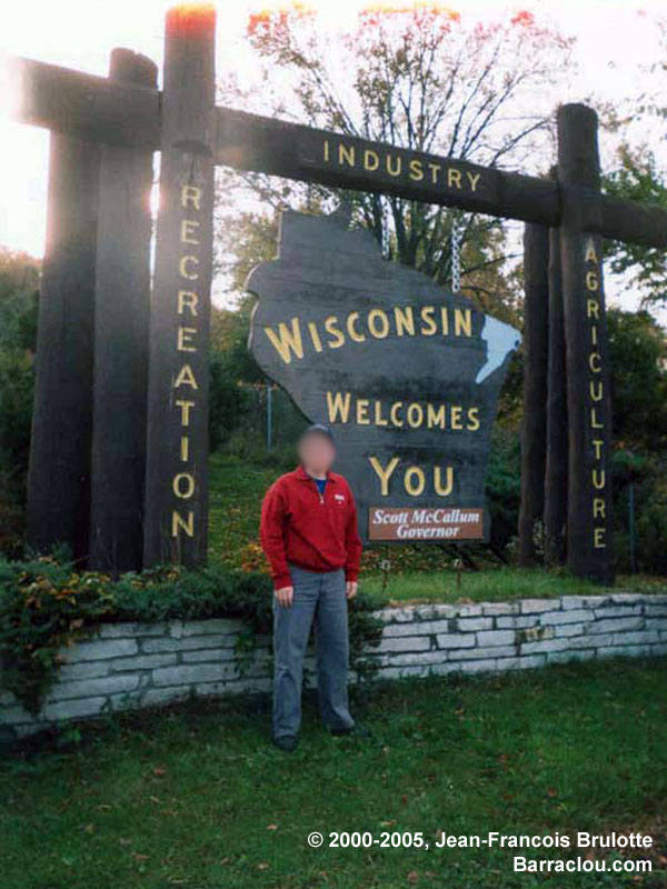
Now you're in Wisconsin. Land of the cheese-heads, badgers, and Illinois vacationers. Head around the curve to the east and you should be on 1st Ct. You'll keep following this until it ends. Follow 116th St. (Kenosha/Pleasant prarie has many streets numbered for your convienience) east to Lakeshore Drive. This is good all the way until it ends at 86th Pl. So go west on 86th place to 85th St, until you hit 7th Ave. 7th Ave has a marked bicycle lane on its eastern side. Note that it accomodates bicycles going both ways. Be aware.
Now you can follow 7th Ave northbound. Then you'll pass Kenosha's water treatment center. (Sometimes it smells funny.) Once north of that, you can head east to Kenosha's Southport Park. This is where you can get on a nice paved bicycle trail along the lakefront. Following this trail then takes you to 1st Ave. A nice quiet ride along the lake. It curves into 71st St. heading west, and then you take 3rd Ave north. Plenty of nice scenic houses (not modern cookie cutter crapola) and some landmark buildings to see along the way.
Then after going north on 3rd Ave a few blocks, there's a turnoff for bicycles on the right. This will take you to Eichleman Park. There'll be a kids playground, and restrooms right at this turn. Then you can take this paved trail all the way to Kenosha Harbor. Lighthouses, parks, vintage electric trolleys, a public museum, places to eat. A nice little place to ride around and enjoy the scenery.
Then you can go back the same way. (Or go another way. I might save that for later.) Feel free to comment...
Here's the general format. I'll name a landmark or location, and its name will have a link to the sattellite view on google maps. That way you'll know exactly where it is. Also if you're enough of a geek to mark off waypoints on a GPS, you can snag the latitude and longitude from the google map address and keep notes.
Start point... Lyon's Woods Forest Preserve. In the pines, the pines, where the sun never shines - the deer flies bite a lot. Well they do at some times of the day, thus a good reason to get moving on your bicycle. But the place does have public restrooms (no running water). Usually there's plenty of parking, so it's a good start point. Follow the trail that goes west (there's two actually, doesn't matter as they meet back up). Cross North Avenue, and keep following the trail westward. If you're on target, you'll meet up with the McClory trail here.
Now follow the McClory trail and head North. There will be a path bridge over Wadsworth Road. The next intersection after this bridge is 33rd Street in Zion. This is where you head east.
Following 33rd Street eastbound, it ends at Sheridan Road. There will be a shopping plaza on the other side. Cross over, and head north through the lot in front of the plaza. Then follow the sidewalk northbound along Sheridan Rd. Immediately there will be a downhill turnoff to the "Edina Park Trail". Paved but bumpy. Also somewhat narrow and on a steep grade. Cover your brakes and use caution. Others on the trail may be going uphill, and there's the occasional tree branch or shopping cart as well.
Now we follow the "Edina Park Trail" until we see the Metra Green Line Zion stop and the defunct Zion Nuclear Plant on your right. You will also see a small playground on your left and a sign for Edina Park (Thus my naming of the trail. I'm uncertain if that's official though.) This is where you turn right onto Shiloh Blvd.
Follow Shiloh Blvd eastbound to a parking lot that's on the left before the nuke plant straight ahead. As far as I know, the nuke plant is retired in place. So don't go nosing around there unless you want to "make friends" with homie-land security.
From this lot, there's a motor vehicle barrier on the north end. This leads to a closed (to motor traffic) road which now functions as a trail. It's very nice and wide, but nature is starting to take it back. Thus it's plenty bumpy in places. If you look towards the lake in the right spot, you can see a perfectly fine Vestas wind turbine being wasted and not doing much. (It would be making some nice kw, if it weren't locked and feathered.) It was part of Commonwealth Edison's (long retired) Powerhouse Educational Center (That cool looking industrial building that's been broken down. What a shame.)
Now follow the path north it ends at another that goes east and west. Go east . At one time it went straight to Lake Michigan, which I think was pretty cool. But some weinie probably worried that people would ride their bikes off it or something (stupid, since it's rocky below), so now there's a piece of driftwood blocking it there. I suppose it makes a nice place to sit and enjoy the quietness. But before getting to the lake, there's another northbound path on your left. You'll go this way unless you want to chill for a bit.
Follow this, and you'll see an aviation omnidirectional beacon (looks like an oversized clothes line thingy) and across from it is a pumping station. (If I had an underground base, I'd hide it here. But that's another story.) Adjacent to those is another spot from which to enjoy the lake and a path that goes west. Follow the westbound path.
On your right is a small bridge. Then you go north again. After moving through some brush and forested area, it opens to a dunesland prarie. There's a park shelter thingy to camp out at if you need to.
Keep following the trail, and you should end up at this parking area near the lake. From there, another little bridge and a trail that continues northbound.
Now follow the gravel trail that stays nearest the lake (easiest to follow for directions sake.) It will head westbound again. You're on the right path if you end up in front of the head/duty ranger's dwelling. (A nice little perk for state park service people.)
Now follow the trail/ranger's driveway west/northward and eventually you'll end up in one of the parking lots at Winthrop Harbor Marina.
Now follow North Point Drive northwards, and there'll be a turnoff with a gate. (There's also a fire trail to the west that can get you through. Potentially muddy in spots, but still an alternative if the gate is locked.)
Head back west and northwards on North Point Marina drive. Plenty of boats and equipment around. Always keep a head on a swivel to watch out for trucks and trailers. Eventually you'll end at a gravel lot with some yard houses around. Stay clear of the buildings and boats, and there'll be a tubular metal gate. This is the lakefront's backdoor to Wisconsin. It's sandy and gravelly there, with enough room to bicycle around it. This is where a hybrid or mountain bike comes in handy with fat tires and low gears. A road bike is likely to flop and die (unless you walk) at this point because of the very loose "technical" road bed.
Now you're in Wisconsin. Land of the cheese-heads, badgers, and Illinois vacationers. Head around the curve to the east and you should be on 1st Ct. You'll keep following this until it ends. Follow 116th St. (Kenosha/Pleasant prarie has many streets numbered for your convienience) east to Lakeshore Drive. This is good all the way until it ends at 86th Pl. So go west on 86th place to 85th St, until you hit 7th Ave. 7th Ave has a marked bicycle lane on its eastern side. Note that it accomodates bicycles going both ways. Be aware.
Now you can follow 7th Ave northbound. Then you'll pass Kenosha's water treatment center. (Sometimes it smells funny.) Once north of that, you can head east to Kenosha's Southport Park. This is where you can get on a nice paved bicycle trail along the lakefront. Following this trail then takes you to 1st Ave. A nice quiet ride along the lake. It curves into 71st St. heading west, and then you take 3rd Ave north. Plenty of nice scenic houses (not modern cookie cutter crapola) and some landmark buildings to see along the way.
Then after going north on 3rd Ave a few blocks, there's a turnoff for bicycles on the right. This will take you to Eichleman Park. There'll be a kids playground, and restrooms right at this turn. Then you can take this paved trail all the way to Kenosha Harbor. Lighthouses, parks, vintage electric trolleys, a public museum, places to eat. A nice little place to ride around and enjoy the scenery.
Then you can go back the same way. (Or go another way. I might save that for later.) Feel free to comment...
# posted by pauljs75 @ 12:30 AM 
![]()